Trefferliste "Maps" - alle Bücher, CDs, LPs und mehr
Ihre Suche nach "Maps" (Bücher, CDs, LPs und mehr) ergab 1000 Treffer.

North Sea Echoes
Really Good Terrible Things
lieferbar innerhalb von 3 Tagen
CD
Aktueller Preis: EUR 16,99
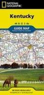
National Geographic Maps
Kentucky Map
lieferbar innerhalb 1-2 Wochen
Karten
Aktueller Preis: EUR 11,95
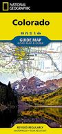
National Geographic Maps
Colorado Map
lieferbar innerhalb 1-2 Wochen
Karten
Aktueller Preis: EUR 11,95
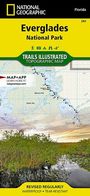
National Geographic Maps
Everglades National Park Map
lieferbar innerhalb 1-2 Wochen
Karten
Aktueller Preis: EUR 14,96

Philip'S Maps
Philip's Navigator Trucker's Britain
lieferbar ab 7.1.2027.
Buch
Aktueller Preis: EUR 42,94

A-Z Maps
Liverpool A-Z Street Atl Pb
lieferbar in mind. 4 Wochen
Buch
Vorheriger Preis EUR 12,23, reduziert um 12%
Aktueller Preis: EUR 10,71
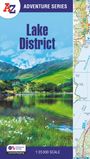
A-Z Maps
LAKE DISTRICT_A-Z ADVENTURE PB
lieferbar in mind. 4 Wochen
Buch
Vorheriger Preis EUR 16,49, reduziert um 12%
Aktueller Preis: EUR 14,43
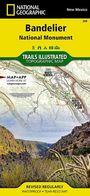
National Geographic Maps
Bandelier National Monument Map
lieferbar innerhalb 2-3 Wochen
Karten
Aktueller Preis: EUR 14,96

National Geographic Maps
Berlin Map
lieferbar innerhalb 2-3 Wochen
Karten
Aktueller Preis: EUR 11,95
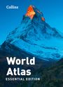
Collins Maps
Collins World Atlas: Essential Edition
lieferbar in mind. 4 Wochen
Buch
Aktueller Preis: EUR 20,21

A-Z Maps
Manchester A-Z Street Atl Pb
lieferbar in mind. 4 Wochen
Buch
Vorheriger Preis EUR 12,23, reduziert um 12%
Aktueller Preis: EUR 10,71

A-Z Maps
HADRIANS WALL_A-Z ADVENTURE PB
lieferbar in mind. 4 Wochen
Buch
Vorheriger Preis EUR 16,49, reduziert um 12%
Aktueller Preis: EUR 14,43

National Geographic Maps
Road Atlas United States, Canada, Mexico, Adventure Edition
lieferbar innerhalb 1-2 Wochen
Buch
Aktueller Preis: EUR 28,41

Black Map
Hex (Limited Edition)
Artikel am Lager
LP
Vorheriger Preis EUR 34,99, reduziert um 14%
Aktueller Preis: EUR 29,99
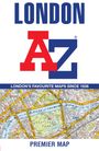
A-Z Maps
London A-Z Premier Map Mfo
lieferbar in mind. 4 Wochen
Karten
Vorheriger Preis EUR 12,23, reduziert um 12%
Aktueller Preis: EUR 10,71
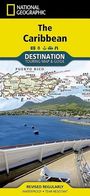
National Geographic Maps
Caribbean Map
lieferbar innerhalb 1-2 Wochen
Karten
Aktueller Preis: EUR 14,96

National Geographic Maps
North Carolina Map
lieferbar innerhalb 1-2 Wochen
Karten
Aktueller Preis: EUR 9,98

A-Z Maps
A-Z Great Brit Handy Rd Sp
lieferbar in mind. 4 Wochen
Buch
Vorheriger Preis EUR 12,23, reduziert um 12%
Aktueller Preis: EUR 10,71
Informationen zur Lieferbarkeit bzw. zu Veröffentlichungsterminen von Artikeln beruhen auf Vorabinformationen unserer Lieferanten. Diese Termine sind ohne Gewähr und können sich jederzeit ändern.