A-Z Maps: A-Z Great Brit Handy Rd Sp, Kartoniert / Broschiert
A-Z Great Brit Handy Rd Sp

(soweit verfügbar beim Lieferanten)
- Verlag:
- Harper Collins Publishers - UK Wholesale Acct, 03/2026
- Einband:
- Kartoniert / Broschiert
- Sprache:
- Englisch
- ISBN-13:
- 9780008778996
- Artikelnummer:
- 12274876
- Umfang:
- 256 Seiten
- Gewicht:
- 270 g
- Maße:
- 192 x 142 mm
- Stärke:
- 16 mm
- Erscheinungstermin:
- 12.3.2026
- Serie:
- Geographers' A-Z Map Co Ltd
- Hinweis
-
Achtung: Artikel ist nicht in deutscher Sprache!
Klappentext
Navigate your way around Great Britain with this detailed and easy-to-use A-Z Road Atlas
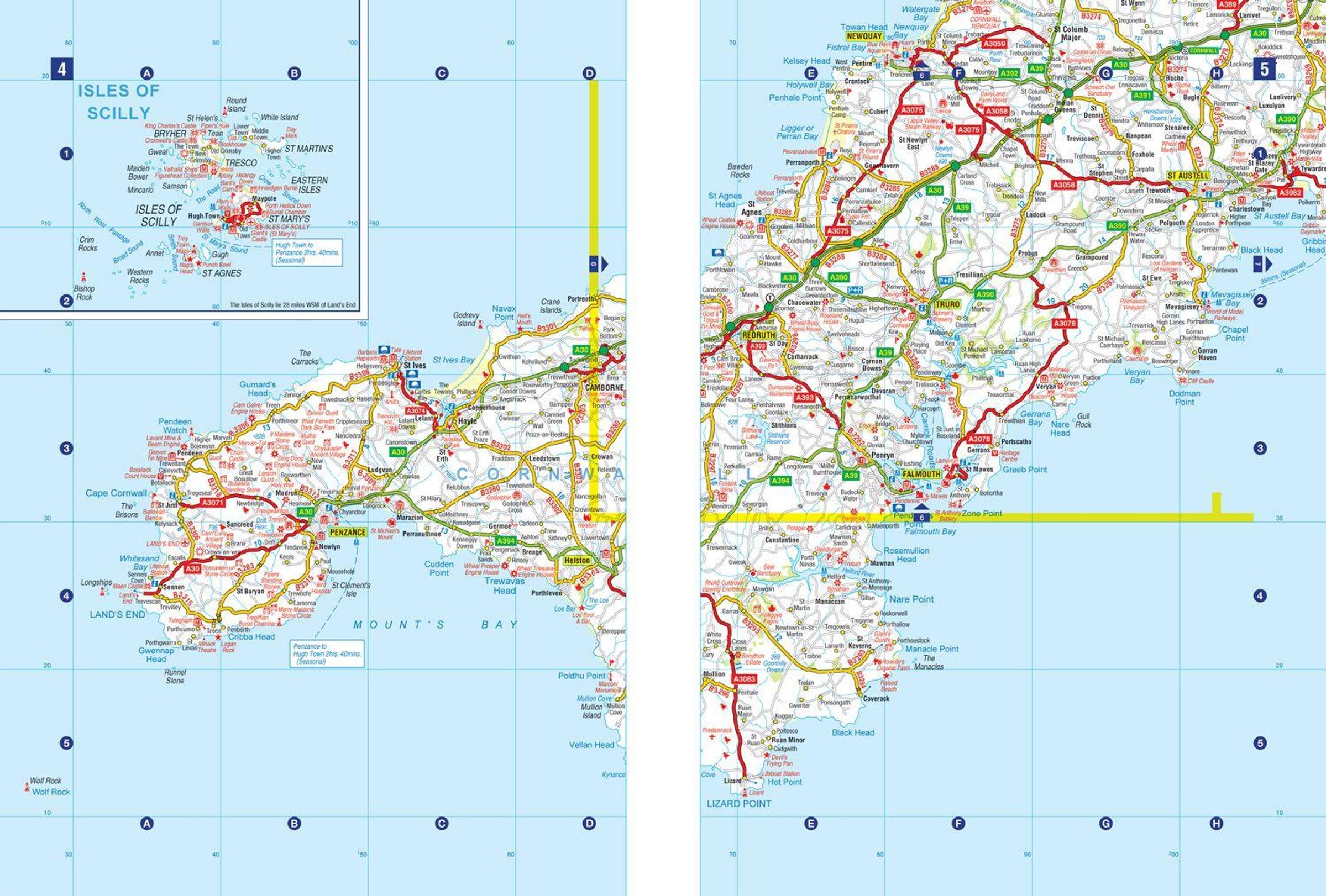
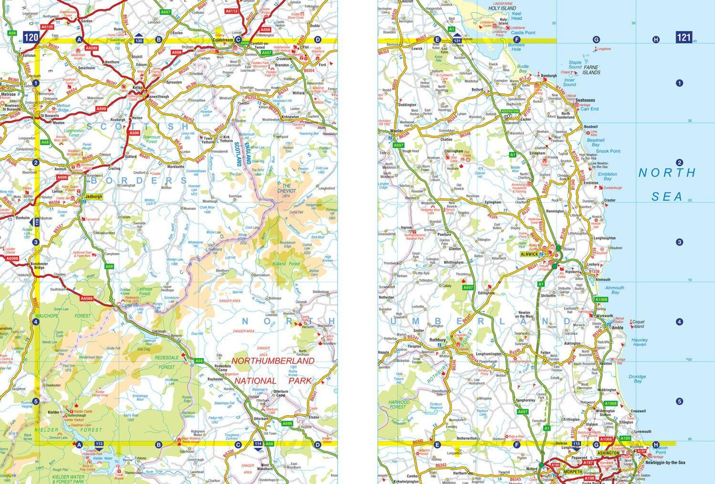
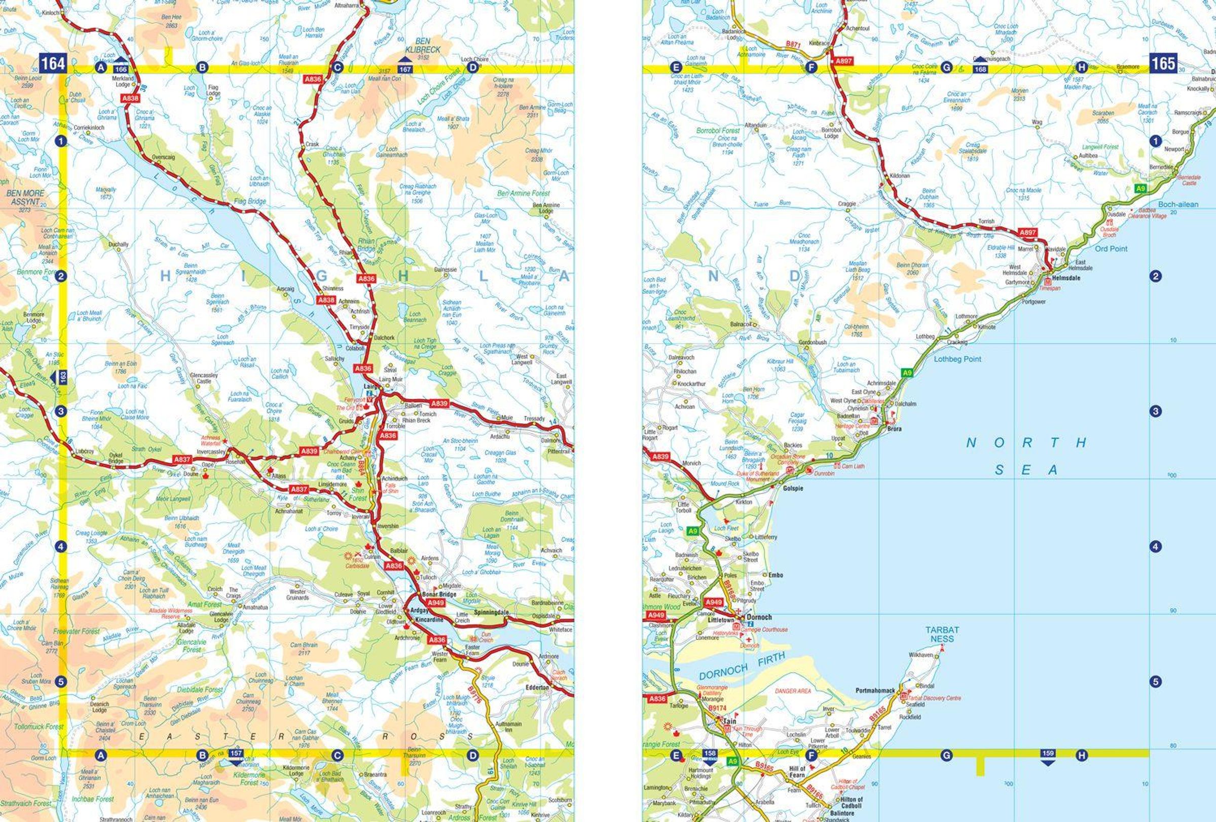
A full-colour, spiral bound road atlas, now fully revised and updated. Clear detailed road mapping at a scale of 5 miles to 1 inch. Presented in a compact A5 size for ease of storage.
This handy road atlas of Great Britain includes:
- Mileage chart
- Channel Tunnel terminus maps
- Index to cities, towns, villages, hamlets and major destinations
- Map reference information also in French and German
Instantly recognisable and easy to use, the road mapping has been specifically tailored for the smaller scale featuring: clear standard road classification colours for easy identification, motorway junction symbols, under construction and proposed roads, primary route destinations, service areas, National and county boundaries, and a wide range of tourist and ancillary information, including Blue Flag Beaches.
This A-Z Handy Road Atlas of Great Britain and Northern Ireland is the perfect choice for those wanting a compact spiral bound publication with A-Z quality road mapping.