Philip'S Maps: 2028 Philip's Big Easy to Read Britain Road Atlas (A3 Paperback), Kartoniert / Broschiert
2028 Philip's Big Easy to Read Britain Road Atlas (A3 Paperback)
- The detail you need at a size you can read
Sie können den Titel schon jetzt bestellen. Versand an Sie erfolgt gleich nach Verfügbarkeit.
- Verlag:
- John Murray Business, 03/2027
- Einband:
- Kartoniert / Broschiert
- Sprache:
- Englisch
- ISBN-13:
- 9781849077637
- Artikelnummer:
- 12695586
- Umfang:
- 240 Seiten
- Gewicht:
- 1063 g
- Maße:
- 394 x 287 mm
- Stärke:
- 13 mm
- Erscheinungstermin:
- 18.3.2027
- Hinweis
-
Achtung: Artikel ist nicht in deutscher Sprache!
Klappentext
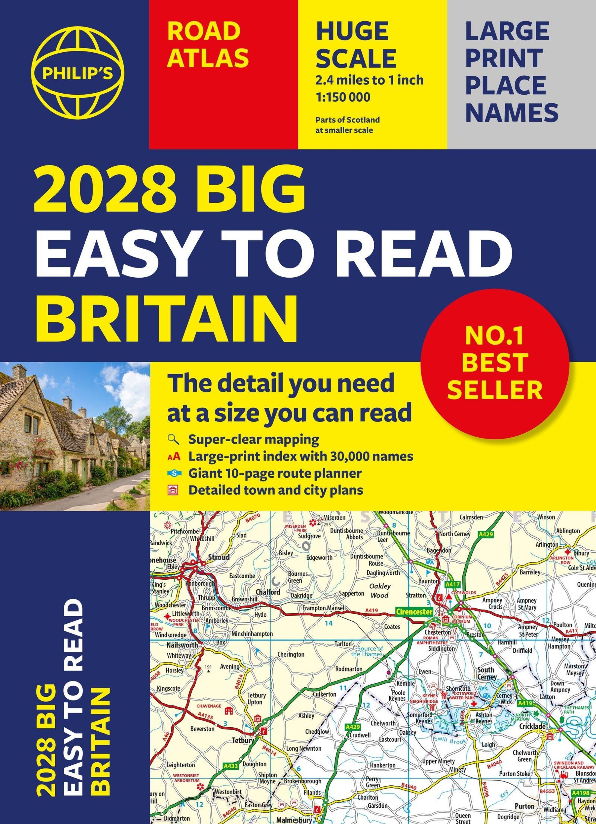
With the detail you need at a size you can read, the latest edition of2028 Philip's Big Easy to Read Road Atlas of Britain issuper-clear, super-sized and bang up-to-date in a large paperback format.
·Huge 1: 150, 000 scale (approx 2.4 miles to 1 inch)
· Large super-sized pages (A3)
· Large print place names, and large scale maps
· 88 detailed town plans showing low-emission zones
·Clear road colours, which are easier to read in the dark
·Thousands of attractions clearly mapped
· Special route planner section for arranging the best trips
· Large print approach maps for all major cities
· Durable paperback format
· Over 100, 000 copies of the Philip's Easy Read Road Atlases of Britain sold since launch in 2020.
At last, a road atlas that everyone can read easily in or out of the car, no matter what the conditions. Restricted motorway junction information, a distance chart, and clearly labelled places of interest are just some of the features within this bestselling road atlas of Britain. Whether it's getting dark, or you just can't find your glasses, 2028 Philip's Big Easy to Read Road Atlas of Britain is the ultimate road companion.
Mehr von Philip'S Maps
-
Philip'S MapsPhilip's Navigator Trucker's BritainBuchAktueller Preis: EUR 42,94
-
Philip'S Maps2028 Philip's Big Easy to Read Road Atlas of Britain (A3 Spiral)BuchAktueller Preis: EUR 27,78
-
Philip'S Maps2028 Philip's Easy to Read Road Atlas of Britain (A4 Paperback)BuchAktueller Preis: EUR 25,90
-
Philip'S MapsPhilip's Navigator BritainBuchAktueller Preis: EUR 43,57